According to NORAD, Santa historically visits the South Pacific first, then New Zealand and Australia. After that, he shoots over to Asia, across to Africa, then onto Western Europe, Canada, the United States, Mexico, and Central and South America. But as NORAD points out, Santa's journey can be affected by weather, just like any other traveler. So how do they keep track?
As described by NORAD's Santa website, tracking Santa begins with NORAD's radar system called the North Warning System, which consists of 47 installations across the northern border of North America. Beginning on Christmas Eve, NORAD monitors these radar systems for indications that Santa has left his workshop at the North Pole. When radar senses Santa's lift-off, NORAD's second detection system comes into play. Satellites positioned in geo-synchronous orbit at 22,300 miles from Earth's surface are equipped with heat-detecting infrared sensors. "Amazingly," the NORAD website states, "Rudolph's bright red nose gives off an infrared signature, which allows our satellites to detect Rudolph and Santa."
|
Standards from the U.S. voluntary standards community can perhaps help NORAD track the magic of Santa and his reindeer. IEEE, a member and accredited standards developer of the American National Standard Institute (ANSI), has developed several standards for radar, including IEEE Std 686-2008, IEEE Standard Radar Definitions, which establishes definitions to promote clarity and consistency in the use of radar terminology.
And when it comes to infrared satellite imaging, ANSI member and audited designator ASTM International can help lead the way. Infrared satellite imaging works by capturing sensory data about the temperature of infrared radiation, or heat, emitted from the Earth. Special cameras detect differences in temperature and then assign false colors to them in order to create a picture that can be interpreted by the human eye. ASTM International has published several standards that support thermal infrared imaging, including ASTM E1311-89(2010), Standard Test Method for Minimum Detectable Temperature Difference for Thermal Imaging Systems, and ASTM E1213-97(2009), Standard Test Method for Minimum Resolvable Temperature Difference for Thermal Imaging Systems.
ASTM E168-06, Standard Practices for General Techniques of Infrared Quantitative Analysis, also covers the techniques most often used in infrared quantitative analysis, including practices associated with the collection and analysis of data on a computer and those that do not.
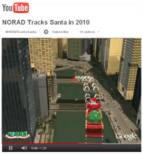
As the data is collected on Christmas Eve, it is then put into Google Maps and Google Earth so that families worldwide can follow Santa. And though tracking officially begins on December 24, early visitors to NORAD's Santa website can revisit Christmas past by watching last year's path.
Ho, Ho, Ho!
The History of Tracking Santa